


Build Powerful Mapping and Location Analytics Applications
Travel times, Routing, Points of Interest, and Isochrones – Targomo provides high-performance developer tools to build state-of-the-art geospatial analytics applications, enhance location search, and personalize user experiences.
BENEFITS
Innovative API Suite for Geospatial Application

Fast & Performant
With fast processing and very precise routing, Targomo’s developer tools provide everything you need to build high-end geospatial applications. Don’t limit yourself to broad-stroke, generic analytics.

Highly Configurable
Don’t compromise implementation or app functionalities with our built-in customization options that let you adapt your solution to unique and novel scenarios, no matter how complex they are.

Sophisticated Analytics
Go beyond standard offerings with advanced analytics. Use calculated travel times to points of interest and other statistical data sets to develop more features and provide additional insights to the user of your application.

Free €300 Credit
Our pay-as-you-go pricing for public and free applications comes with a credit of €300 and allows you to start building right after sign-up.
API Portfolio
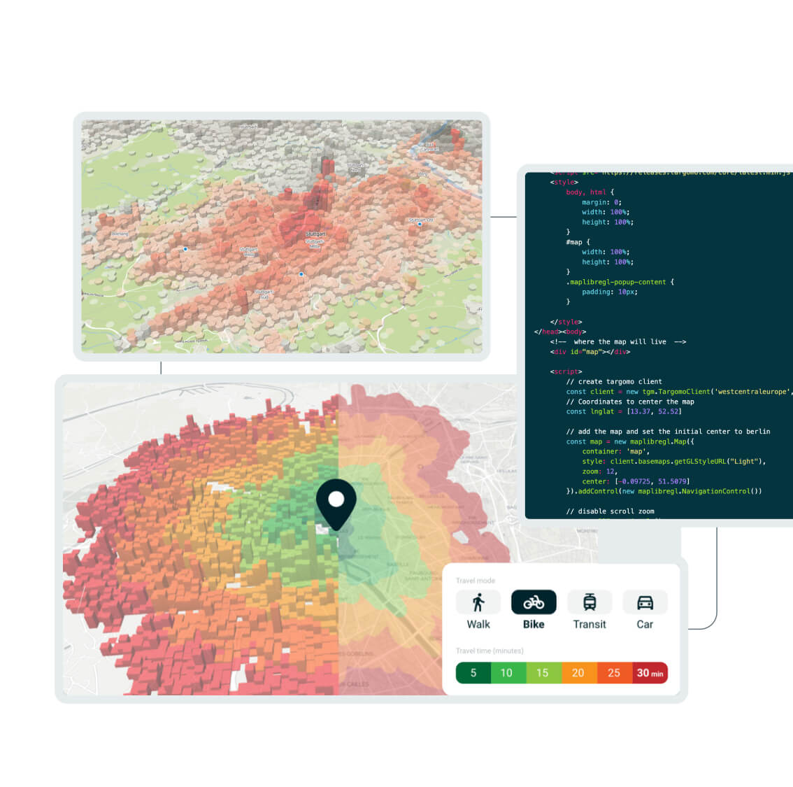
A High-Performance Toolset for Custom Maps & Geospatial Analytics
 CREATE
Create custom maps for your web applications
Basemaps API:
Get custom maps as reference base layer for your geospatial data visualization
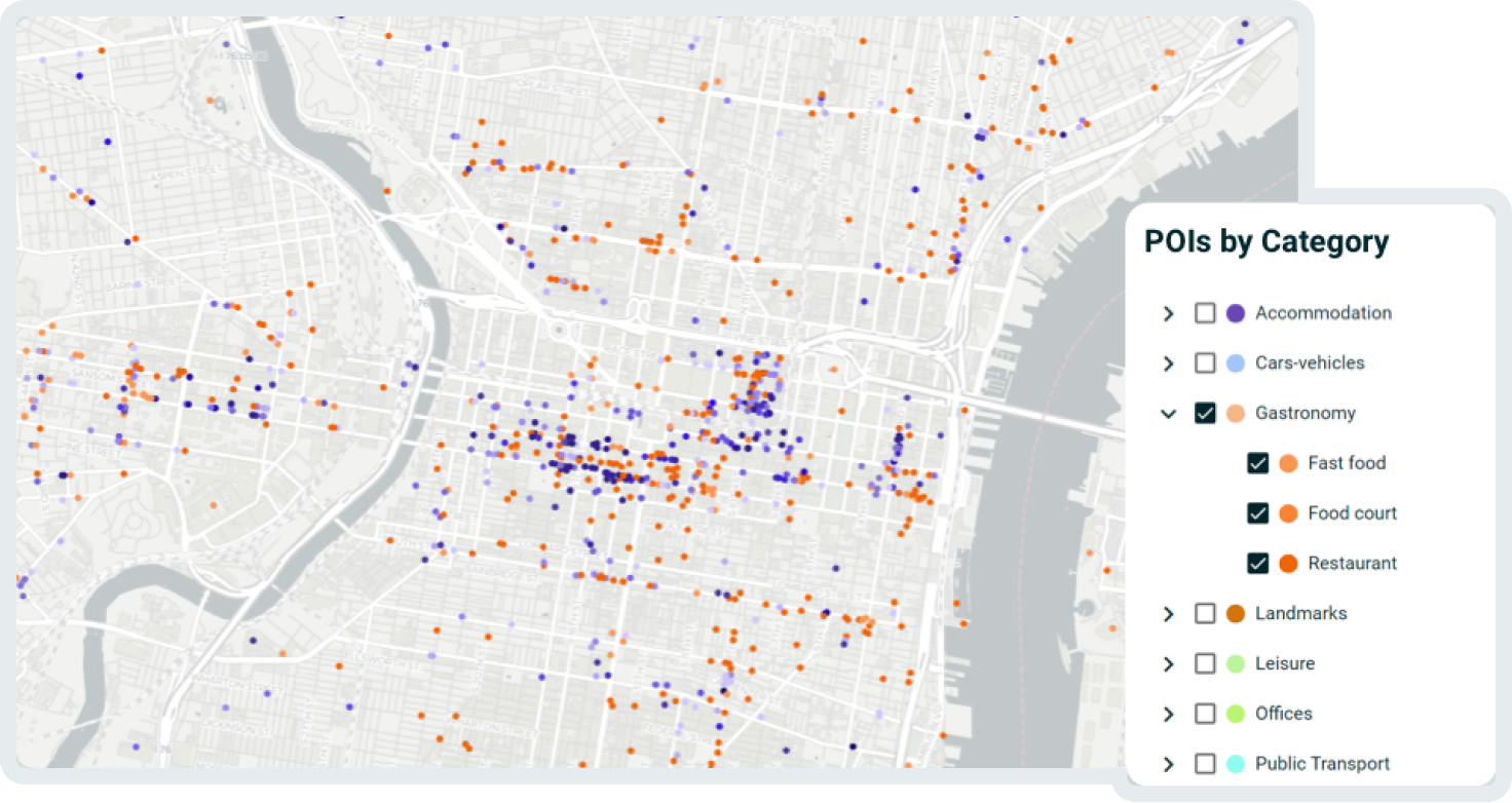
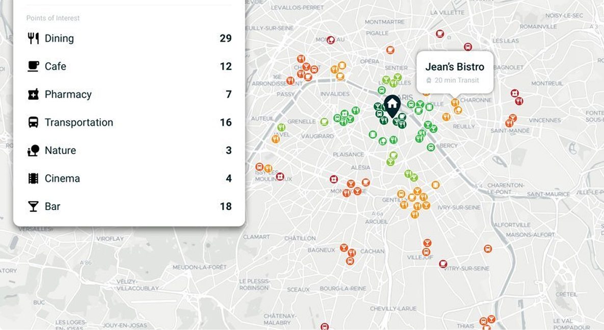
Places Layers API:
Enhance your maps with Points of Interest
Statistics Layers API:
Visualize additional data by adding reference layers to your map
 Analyze
Analyze and visualize geospatial data
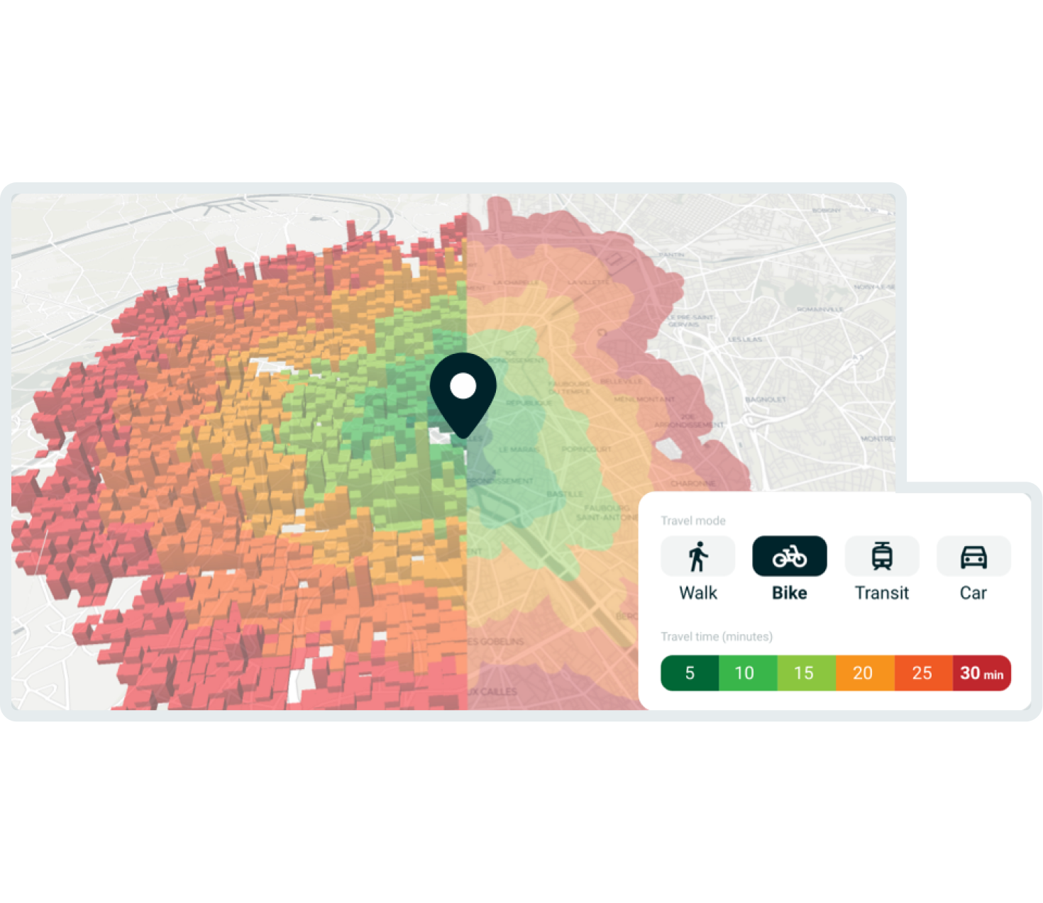
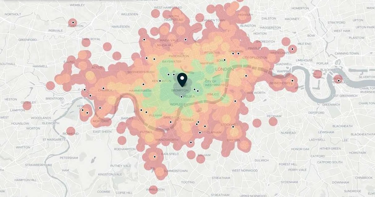
Isochrone API:
Visualize on a map areas that people can reach from one or more starting points
Travel Times API:
Calculate precise travel times to a large number of targets
Multigraph API:
Get fine-tuned, configurable visualizations for complex reachability scenarios
Places Context API:
Add context to locations by identifying the closest points of interest
Statistics Context API:
Generate valuable insights by combining the reachability of locations with statistics
 NAVIGATE
Get detailed directions for multiple routing scenarios
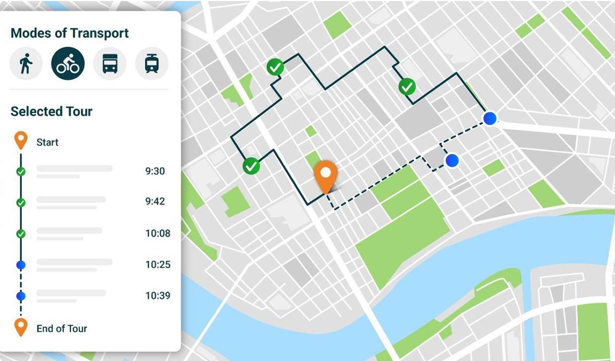
Routing API:
Get detailed routing information for car, bike, walk, and transit
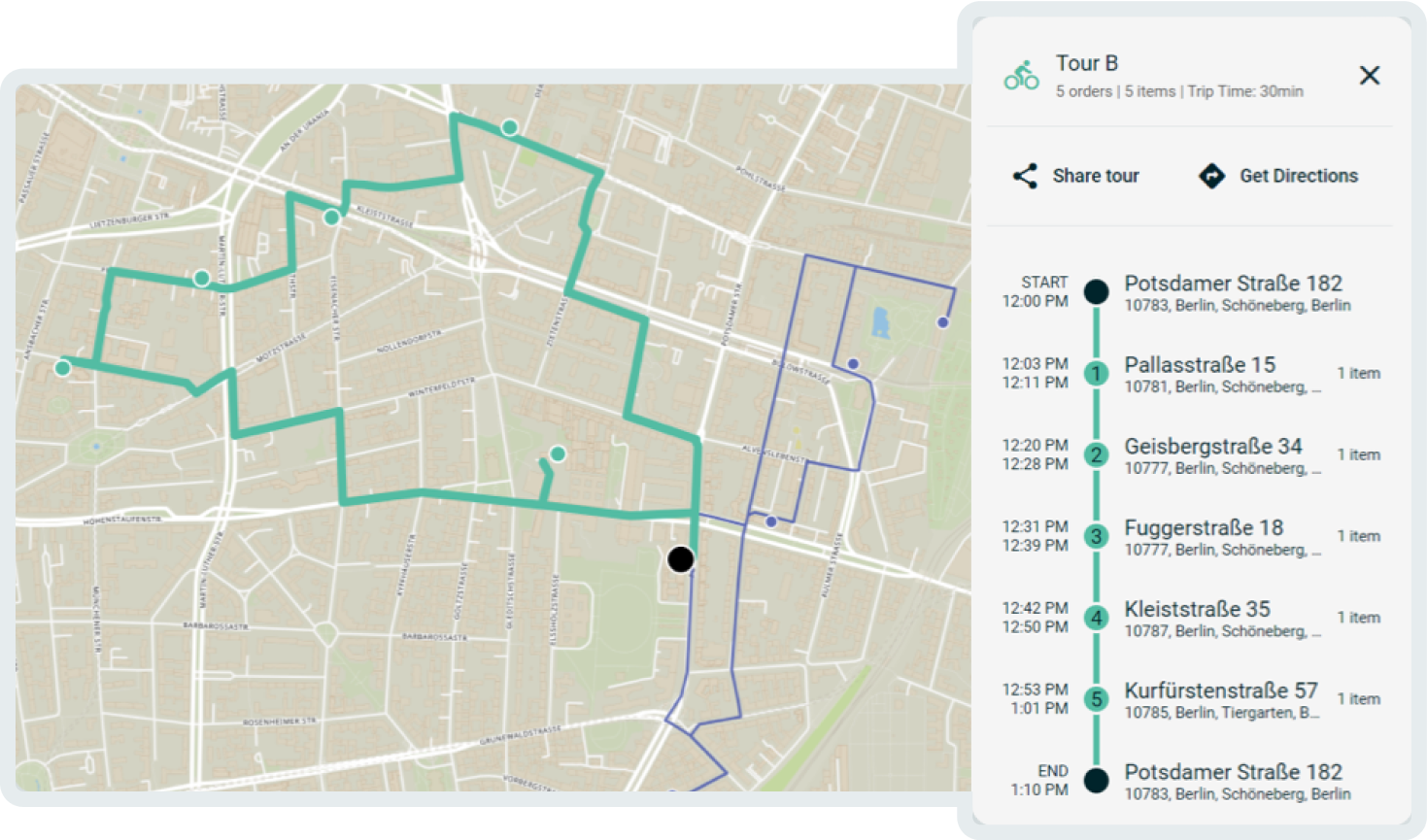
Fleet API:
Find the best route combinations for multi-vehicle and multi-destination scenarios
Ready to get started?
Get your free API key or talk to one or our experts.
Use Cases
Real-World Applications of TargomoAPI
Real Estate Search
It is not the broadest listings that are key to winning the competition, but the most relevant ones: We enable real estate portals to offer best-in-class features with powerful search, filtering, and ranking functionalities that drive conversion and which home seekers will love. Read more about how we empower the Real Estate industry.
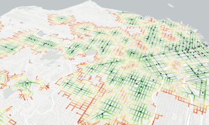
Logistics Optimization
We help you plan the optimal routes for delivery vehicles, field experts or maintenance round trips. Considering individual variables like load restrictions and deadline prioritizations, our software meets all your specific business needs.
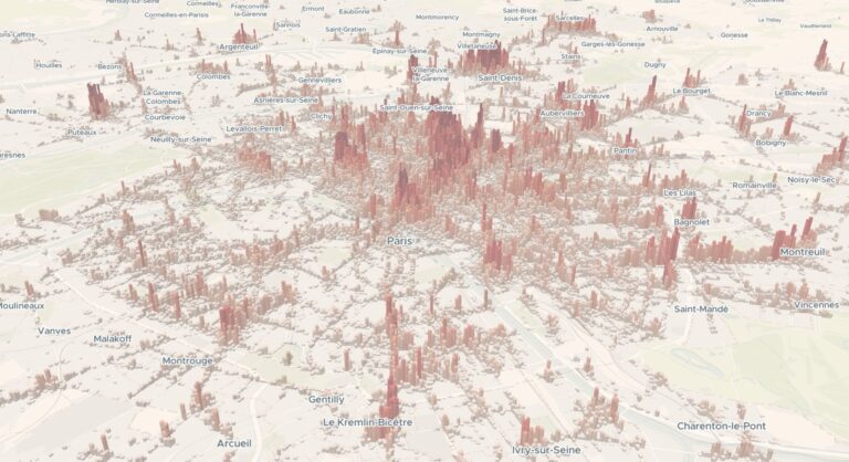
POI Visualization
What determines the character of an area? Besides the region, it is the surroundings like restaurants, bars, shops, leisure activities or urban supply. Visualizing reachable POIs on a map can lead to unexpected insights.
See What Our Customers Say
Proven Results, Trusted Partners
“Targomo’s API is technically impressive and easy to integrate. Within one month we were ready to launch the new feature.”


Amel Taibi, Senior Product Manager @Seloger

Proven Results, Trusted Partners
“We registered more search subscriptions very early on. We were also able to lower both our exit rate and our bounce rate by 15 percent.”


Silvio Frei, Head Marketing & Communications
OUR CLIENTS


For Developers
TargomoAPI Demo Area
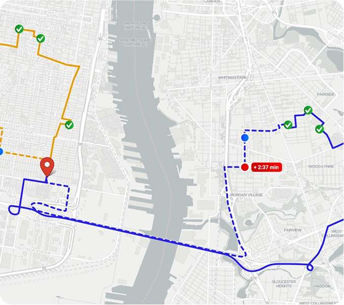
Fleetplanner Explorer
Plan multi-stop routes for multiple vehicles with just a few clicks. Built with TargomoAPI, this tool can be integrated into platforms of your choice with customized solutions and additional features.
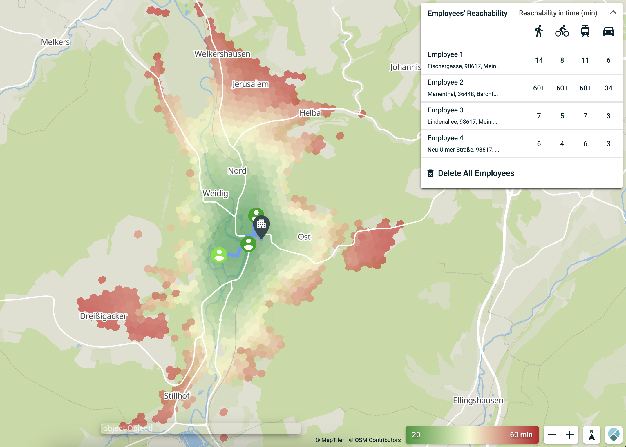
Office Finder Example
Looking to minimize employee commute times or find the best area for relocation? The Office Finder tool helps you identify the most accessible areas in any German city.
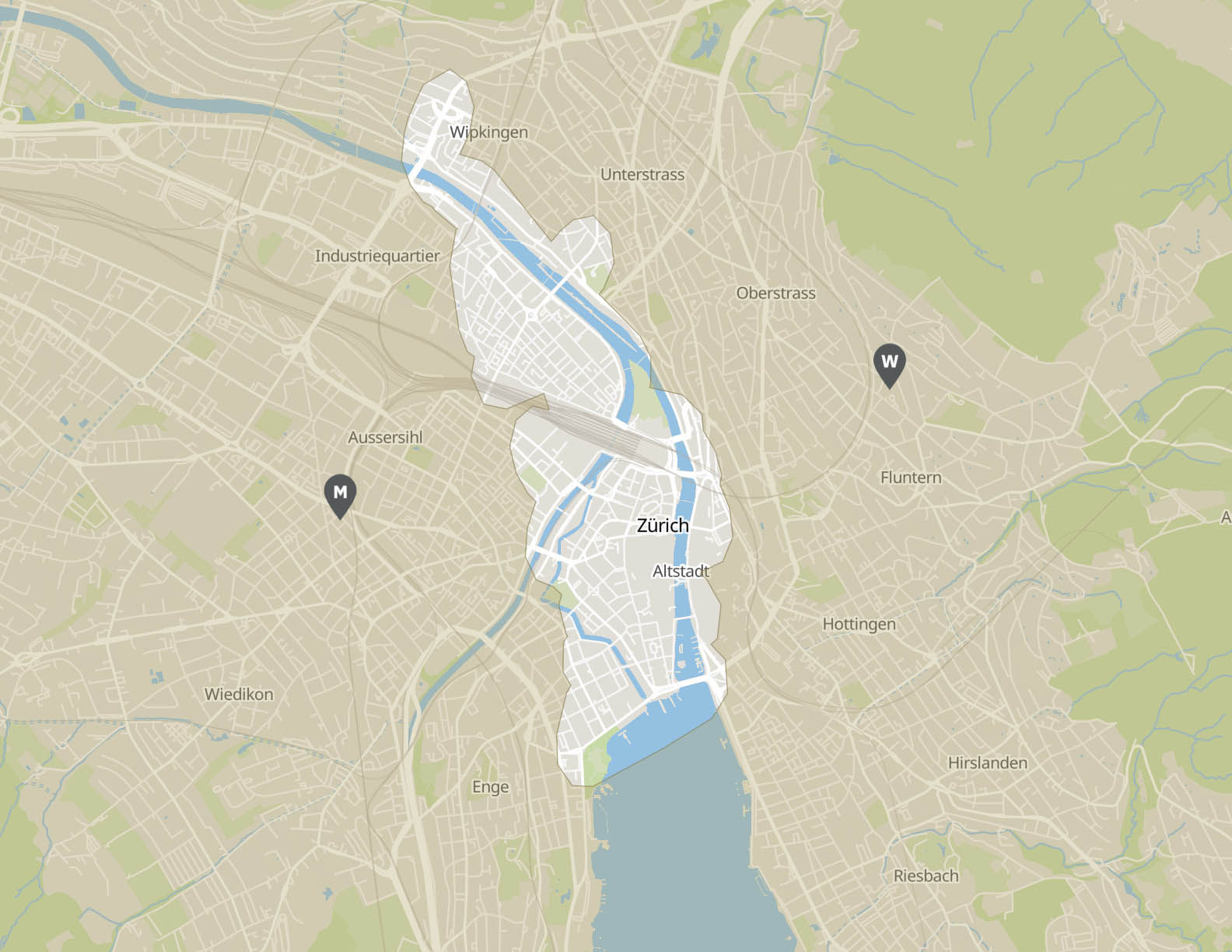
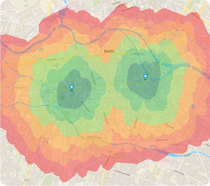
Polygon Demo
Calculate catchment areas of a chosen location based on travel time. Define areas within 5 to 35 minutes of commuting distance using various transportation modes, including transit, car, bike, and walking.
Discover more demos in our Developer Center
Visit Developer CenterLatest News & Updates