Book a demo

HCU Hamburg uses TargomoAPI to advance climate protection

Mar 03 2023 Published by under Blog

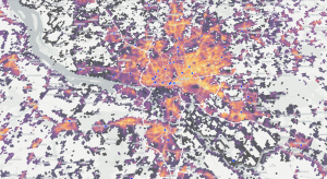
Climate protection initiatives can be launched by planning them down to the last detail from the outset, or they can be tested as a pilot project in a test environment in order to quickly obtain results from practical experience. To support the second approach, HafenCity University (HCU) Hamburg has developed ANN RADAR (A New Normal). Funded by the ICLEI Action Fund, the project helps the city of Hamburg identify suitable spaces and districts for testing sustainable energy innovations, leveraging Targomo’s API services.

ANN RADAR provides a data-driven decision-making basis for finding testbeds for climate protection measures,” explains Kay Hartkopf, senior researcher at HCU Hamburg who is leading the development of ANN RADAR. “The more suitable the areas are for testing, the faster we can gather knowledge and ensure that the measures are implemented on a broad scale.”

The project identified three core topics of sustainable urban development for which the ANN RADAR will select test areas: Mobility, Solar & Photovoltaic, and Energy Efficiency. TargomoAPI is used in particular for scenarios around the topic of mobility. Here, the focus is on planning local logistical mobility centres, as envisaged, for example, in the HCU’s MOVE 21 project. MOVE21 is an innovation project funded by the European Commission that aims to transform European cities and their surroundings into intelligent, emission-free hubs for mobility and logistics.

Answering relevant questions around mobility, accessibility and quality of supply.

“Targomo is a great support for us, as we can use the API to answer relevant questions on mobility, accessibility and supply quality and visualise them on maps,” says Kay Hartkopf. “We particularly benefit from the fast data processing and the wide range of customisation options that enable us to perform complex analyses.”

ANN RADAR is designed as a process support (moderated process for selecting urban testbeds) and was inspired by “A New Normal” in Melbourne, Australia, which is developing prototypes and pilot projects related to a sustainable Melbourne 2030. It collects indicators to find the most suitable urban areas for selected climate protection measures. It also takes into account local climate strategies and available environmental data to support evidence-based decision-making. As different data sources can be quickly integrated and combinations of data sets can be explored, it also promotes stakeholder participation and enables the development of specific perspectives for these target groups.

Building on the experience gained, it is planned to expand ANN RADAR in the future to include further data layers (e.g. environmental data, heat islands, urban green, real-time mobility data) and functions for the exploration of specific project scenarios.It is currently available for HCU projects.

Comments Off on HCU Hamburg uses TargomoAPI to advance climate protection

Targomo releases new API feature to support emergency response

Jan 23 2023 Published by under Blog

A major challenge for emergency response is to provide the right service as quick as possible. The new “polygon exclusion” function allows quickly adapting to unforeseen circumstances by excluding impassable areas from the routing.   

In an emergency situation, quick response times are crucial. They help emergency workers minimise the risk of further injury or damage, and increase the chances of a positive outcome of the incident for those involved. Whether in accidents, emergency medical services or fires, a large part of this response time is determined by the travel of emergency vehicles. However, roads can suddenly become impassable due to sudden events such as environmental factors or protesters blocking roads.

To enable developers and planners to improve their responses in emergency situations, Targomo has released a new feature. The “Polygon Exclusion” feature makes it possible to exclude specific areas (polygons) from the routing at any time. This could be necessary, for example, if there is a road blockage, an area is affected by a fire or a flood causes roads or bridges to become inaccessible – EMS providers can adjust their analyses on-the-fly, without waiting for road data updates. 

However, the new feature not only improves rapid response in emergency situations, but also enables better planning in the event of disasters. Combined with other Targomo data services, emergency planners are able to see how many people need to be cared for or evacuated within a prescribed minimum time. If a bridge washed out, how many people would be inaccessible and need to be cared for? What countermeasures should be initiated? Are the existing locations of, for example, the police or fire brigade sufficient to provide adequate care, or are more locations needed?  

“Emergency management planning is hard, and we need to model the unforeseen. Faced with this challenge, Targomo responded with an efficient and innovative solution,” says Espen Bjerkås, Chief Technology Officer (CTO) at Ada Technologies that uses TargomoAPI to develop and optimise disaster response solutions in Norway.

“The new feature can be used to answer a variety of safety-related questions,” says Adam Roberts, product manager of TargomoAPI. “We developed the feature explicitly according to the wishes and requirements of our rapid response customers, as theywere unable to find such a feature anywhere in the world. The feature is now actively deployed in countries on several continents, including the US, Norway, and Germany, and we hope this will help many people in emergency situations faster and better.”

Targomo provides high-performance developer tools for building state-of-the-art geospatial analytics tools, improving location search and personalising the user experience. The API portfolio is characterised by fast processing and very precise routing and built-in customisation options that allow developers to adapt their solution to all individual scenarios 


Comments Off on Targomo releases new API feature to support emergency response

Immowelt and Targomo team up to facilitate apartment search

Jun 30 2022 Published by under Blog

The location of a property is one of the most important criteria for apartment hunters. The distance to the next supermarket or the connection to public transport can decide whether someone decides for or against a property.

The German real estate portal Immowelt now offers a location check that generates ratings for every listing. The new feature is based on Targomo’s Location Scoring API and allows visitors to Immowelt to assess public transit quality and “daily needs” access.

“The Immowelt location check is a real and tangible added value for searchers on immowelt.de,” says Felix Kusch, Immowelt Country Managing Director. “Anyone who can assess the location of a property at a glance saves valuable time in the search for a suitable apartment or house. In the test phase, users were already enthusiastic about this practical function.”

How the location check works

The Immowelt Location Check is a benchmark for the attractiveness of a property’s location compared to all other property locations in the region. It is calculated based on the number and accessibility of relevant points. The “Daily Needs” score takes into account the extent to which grocery stores, drug stores, ATMs, pharmacies, etc. are reachable within the area. The score “Public Transit” takes into account the proximity and number of transit stops, the amount of transit lines and frequency of their services as well as the effectiveness of the transit network itself – how good is the network at connecting people across areas.

The result is presented on an easy-to-read, five-point scale: Super, Good, Okay, Moderate and Poor. For the future, Immowelt plans to expand the location check with two additional scores: Family-friendliness and leisure opportunities. These are intended to display information about kindergartens, playgrounds or sports facilities, among other things.

Diverse scoring options for locations

Targomo’s Location Scoring API enables the evaluation of locations by analyzing sociodemographic data and the accessibility of relevant places (points of interest) in the vicinity. The criteria according to which locations are evaluated can be set individually. “The high adaptability of the Location Scoring API was one reason, along with the speed and precision of the calculations, why we worked with Targomo to develop the Location Check,” says Felix Kusch.

“We enable real estate portals to provide their users with additional information that they would otherwise research on other websites,” says Henning Hollburg, Managing Director of Targomo. “This allows them to keep users on their own platform. They can customize the scores and tailor them to different countries, cultures or user types, for example. Even an individual weighting of the criteria by the user herself is theoretically possible – for example, a user could specify whether there should be many or few bars or restaurants in a neighborhood.”

Interested to learn more about location scoring with TargomoAPI? Contact us. 


About immowelt:

immowelt is part of AVIV Group, one of the largest digital real estate tech companies in the world.

immowelt’s mission is to digitize all steps of the real estate transaction in the future to make it as uncomplicated and easy as possible for all parties involved. The basis is provided by the wide-reaching immowelt portals, which are among the leading real estate platforms in Germany and Austria. They already successfully bring together owners, real estate professionals and seekers. immowelt supports the uncomplicated search for a rental property, the effective marketing of a property and customized financing of one’s home with data-supported services. Thanks to decades of experience and broad real estate expertise, immowelt thus creates the perfect success story for tenants and landlords, real estate professionals, property owners and buyers.

In addition to immowelt, other leading real estate online marketplaces in France, Belgium and Israel belong to the AVIV Group, which is part of Axel Springer SE.

Comments Off on Immowelt and Targomo team up to facilitate apartment search

The Top 3 Things to Do With Travel Time Isochrones

Sep 13 2021 Published by under Blog

They look beautiful and can be incredibly powerful when added to interactive map applications: Isochrones. Whether you want to show which areas are within walking distance of an office building or analyze the accessibility of a school by public transportation, isochrones offer a quick and easy solution. In essence, they show how far you can travel from a certain starting point, and often the individual travel time segments are also color-coded for better clarity. Here we give a brief introduction to the different ways isochrones can be used.

Targomo offers a wide range of geospatial tools that can be used to perform powerful location-based analysis, visualize detailed statistics, and solve complex logistical problems. However, here we will focus on one of the simplest, but most useful and therefore most popular APIs: the Isochrone API. The Isochrone API is used to visualize reachable areas from a source or a group of sources as polygons. 

So what is an Isochrone? Merriam-Webster defines an isochron(e) as “a line on a chart connecting points at which an event occurs simultaneously or which represents the same time or time difference.”The shapes returned by the Isochrone API represent this by connecting all the furthest reachable points in the routing network from the given sources into a polygon. We refer to these as “reachability polygons” or “isochrones”. The definition is somewhat broader in our case, as we can visualize both time and travel distance, and also provide the ability to define multiple sources and aggregate the resulting isochrones. 

This can be used in a variety of useful applications, all of which fall into one of the 3 following scenarios: 

1. Simple Polygon Reachability 

Simple Polygon Reachability based on public transit


Whenever you want to intuitively visualize the areas that can be reached from a starting point within a certain travel time or distance, isochrones offer a quick, easy and relatively simple solution. You can implement them in such a way that users can choose between car, bike, e-bike, walking and public transport.  

The travel mode is crucial, because the results will vary greatly. This is due to the underlying routing, which represents realistic travel scenarios:  When traveling by train, your journey is largely determined by the location and number of bus and subway stops. When traveling by car, speed limits, the road network and traffic lights determine how far you can travel. 

Since realistic routing always takes into account obstacles such as lakes, rivers, bays, bridges, and mountains, isochrones provide a much more accurate representation of reachable areas than a radius ever could, regardless of the mode of transportation you choose.   


2. Multi-Source Polygons and Polygon Intersections 

Multi Source Polygon with Intersection for Car Reachability


Once you start adding source locations, you can visualize and analyze much more complex reachability scenarios. One of the industries where this is becoming increasingly important is real estate search: On many real estate portals, people looking for apartments can create their individual search area based on several personal addresses (e.g., the workplace and child’s school) as well as the preferred mode of transportation. In a related use case, companies looking for new office buildings are starting to consider their employees’ addresses and commute times.  

It is easy to create polygons with more than one source, and you can define how these sources interact with each other. In terms of Targomo’s Isochrone API, we distinguish between three intersection modes: 

  • The “Union” mode is the default, which combines all generated polygons. This is useful to find out which areas are reachable from any number of locations, e.g. the total coverage area for a collection of stores.  
  • The “Average” mode provides the average reachability from all sources, which is very useful for calculating the “best reachable” area from all sources. This mode can be used to easily find a suitable meeting point or to determine the best location for a supply warehouse for a group of retailers.  
  • The “Intersection” mode, on the other hand, shows only the area that can be reached from all sources, with the greatest distance taking precedence over all other values. This way, for example, it is possible to specify an area that is accessible from both your house and your workplace. 


3. Filtering Targets Using Polygons

Filtering Targets Using Polygons


When displaying a group of locations to a user (such as a client, a business partner, or simply as part of a larger presentation), you may want to filter them by their accessibility from one or more starting locations. This is particularly useful for creating lists that take into account the user’s travel time constraints – for example, displaying workplaces that can be reached within 30 minutes by car, or vacation homes that are a 15-minute walk from the beach.   

With isochrones, it is easy to display only the places that are accessible according to individual travel preferences. The algorithm only needs to check  

By intersecting the point with isochrone polygons, you can determine which time-band the points are within (i.e. “< 10 minutes by car”) and sort them accordingly. This way, you can conveniently filter locations that are either 15, 30 or 45 minutes away from the source and help your users make sense of the data displayed.       

If you want to display or analyze the exact accessibility of places in terms of travel time, you should check out Targomo’s Travel Times API.   


Want to try yourself? 

Are you interested to dive deeper into isochrone creation? Our developer Gideon Cohen created a detailed step-by-step tutorial showing you how to create your own polygon maps with JavaScript. You could also jump directly into the code in the corresponding Github Repository.    


Comments Off on The Top 3 Things to Do With Travel Time Isochrones

A Leading Real Estate Platform Uses Location Intelligence to Transform House Hunting

Nov 14 2019 Published by under Blog

French real estate platform SeLoger has made it easier for customers to find the home that matches all their needs.

For real estate platforms, staying ahead of the competition isn’t an easy task: house hunting changed little over the years. Do you want a garden? Two rooms? A central location? These standard questions don’t reflect the complexities of life, let alone the hustle and bustle reality of urbanites. SeLoger, one of France’s most popular real estate platforms, introduced a ground-breaking way to deliver a better search experience: house seekers can now filter results by commute times. Targomo made this possible.

The Importance of Travel Time in Real Estate Search

In 2017, SeLoger partnered with Targomo to implement an innovative idea. They realized that searching for a new home by postal code is static and simplistic. Instead, people’s lives revolve around a variety of locations (work, gym, university, kindergarten to mention a few) and the different ways to get there (car, public transport, bike, or on foot). In other words: The location of the perfect home is determined by its relation to the places that matter most and the time it takes to get there.

SeLoger, part of German media and classifieds group Axel Springer, decided to help its 30 million monthly users find a home that reflects life in all its complexity. They did so by incorporating Targomo’s travel time polygons into their platform.

Location Intelligence in Action

Imagine a parent who wants to limit her drive to work to 30 minutes. At the same time, she wants to live within 20 minutes from her daughter’s kindergarten by public transport. Most real estate platforms wouldn’t know how to answer these requests. But with the help of Targomo’s API, people can use SeLoger to set two places that matter to them, how they want to get there, and how fast.

As a result, listings that fit these preferences are clearly visualized. People can focus on realistic locations and feel confident that their needs are met. As an added benefit, they might discover new neighborhoods they had not considered before.

French real estate platform SeLoger offers its clients a better search experience, allowing them to take into account travel times to their offices, gyms, childrens' schools and train stations.

Integrating Targomo’s API is Easy and Quick

When looking for a partner to implement its new location intelligence feature, SeLoger thoroughly surveyed the market. Ultimately, they chose Targomo’s API for its technical capabilities – Targomo includes several means of transport, allows for multiple destinations, and easily integrates into existing platforms. After only one month, SeLoger launched the new location intelligence feature on their platform.

[quote text=”The Targomo API is technically impressive and easy to integrate. Within one month we were ready to launch our new feature.” type=”long” name=”Amel Taibi” role=”Head of Product at SeLoger”]

Before integrating travel time, only 4% of all home seekers on SeLoger used maps to visualize real estate offers. Most people still relied on lists without spatial context. Today, that number is 10%. In other words: 3 million monthly users rely on location intelligence to find their next homes.

Unexpected Customer Insights and Bold Experiments

Location Intelligence also delivers new customer insights. SeLoger realized that most people prefer to drive up to 30 minutes to their work or particularly look for schools around real estate offers. These insights help the company to continuously improve the user experience.

SeLoger also offers other services in the real estate sector and they believe that location intelligence will be useful in a variety of applications: searching for holiday homes, planning new construction projects or finding the optimal coworking space. Targomo API can help in all these use cases.

Learn more about our services for real estate platforms.

Comments Off on A Leading Real Estate Platform Uses Location Intelligence to Transform House Hunting

We use cookies on our website. They provide us with web analytics, helping to give you the best possible experience on all pages. To learn more and see a full list of cookies we use, visit our Privacy Policy

Essential Cookies
Google Analytics
HotJar
We use cookies on our website. They provide us with web analytics, helping to give you the best possible experience on all pages. To learn more and see a full list of cookies we use, visit our Privacy Policy.
These cookies help us understand how you use the website — which pages are most visited, how long users stay, and how they navigate. All data is anonymous. Enabling these helps us improve the site.
These cookies track clicks, scrolling, and how you interact with content. They allow us to analyze usage through heatmaps and session recordings. You can disable these if you prefer not to share this type of data.