Places Context API
Add context to locations by identifying the closest points of interest.
Key Features
- Global coverage of measurable places
- Hierarchical categorization for grouping place types
Use Scenarios
Improve a business listing with reachable infrastructure
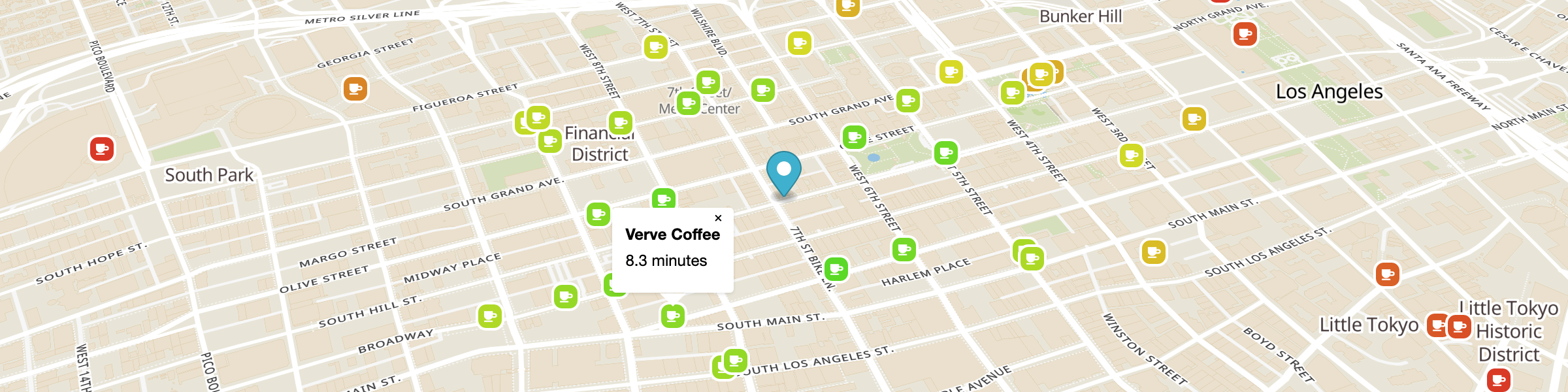
Find the closest subway entrance to a location and display the walk time. Sorting results by travel time enables identifying the closest one.
Score locations based on reachable counts
List the number of cafés within a short walk of all locations to compare locations. Combine counts of various reachable place types to create composite scores.
Inputs
Basic inputs (see docs for more)
- osm types: array of key:value pairs of desired OSM point types
- sources: array of starting points
- edge weight: “time” or “distance” optimization
- max edge weight: maximum time/distance to search for places
- travel type: “walk”, “bike”, “car”, “transit”
- format: Output format
- “json” or “geojson” output format
Outputs
Basic outputs (see docs for more)
- json format: Custom json format, less verbose than GeoJSON, with edge weight for each place, as well as available OSM tags
- geojson format:" GeoJSON FeatureClass (Point), with edge weight for each place, as well as available OSM tags
- Tiled Outputs
- MVT: Mapbox Vector Tile format, with edge weight for each place, as well as available OSM tags
- Tiled GeoJSON: ZXY tile containing GeoJSON FeatureClass (Point), with edge weight for each place, as well as available OSM tags
Operations counting strategy for public use
maxRoutingtime: each 60 minutes is counted as 1 operation.
sources: each source point = 1 operation.
tiled responses: MVT and tiled-geojson results are assigned a 1/15th multiplier.
counting factors are multiplicative…
examples:
- 1 source, 60 minutes = 1 operation.
- 2 sources, 60 minutes, MVT tiles = 2 operations for each 15 returned tiles.