Places Layers API
Enhance your maps with Points of Interest.
Key Features
- Easy integration of POIs in your map – all at once or categorized to your needs
- Clustering of adjacent similar points to keep maps clean-looking
Use Scenarios
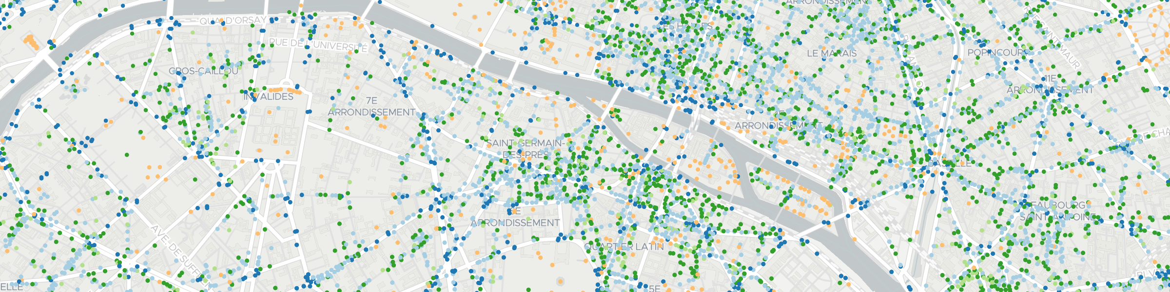
Augment basemap with tiled, grouped place types
Toggle on and off globally available place classes to add reference to the map.
Show concentrations of place types by hexagons
Setting layerType=hexagon allows the aggregation of points of interest to show hot-spots.
Inputs
Basic inputs (see docs for more)
- osm groups: hierarchy groups (i.e. all clothing store tags grouped together =
g_clothing- see all hierarchies) - osm types: array of key:value pairs of desired OSM point types
- layer type: “node” for point or “hexagon” for aggregating points to a hexagon coverage
- many, many more…
Outputs
Basic inputs (see docs for more)
- json array: Array of all matched places
- Tiled Outputs
- MVT: Mapbox Vector Tile format with
- Tiled GeoJSON: ZXY tile containing GeoJSON FeatureClass (Polygons or Point, depending on
layer typeconfiguration)
Operations counting strategy for public use
One tile request counts as one operation.
1,000,000 tiles could be requested with the 300 € monthly use-credit.